|
High resolution maps suitable for printing & framing available for a donation
While it is our goal to provide access to all the information we collect to all for free, we do occasionally incur costs in collecting
information. To help recoup some of these cost, the following High resolution maps suitable for printing & framing available for a donation of $25 to the Emmitsburg Historical Society.
So if you're a lover of Emmitsburg's history, and would like to help us in our effort, please consider making a contribution. If you're comfortable with using Pay-Pal, please click on the button to the right and
make your donation on line. The suggested donation for each map is $20 or all three for $40.
Otherwise, please e-mail us at History@emmitsburg.net and we give you an
address to send a check to.
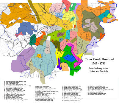
This map, produced by the Emmitsburg Historical Society, show the boundaries
of the original land grants and grant holders for the Town's Creek Hundred Areas
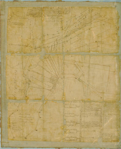
This map, draw in 1797, shows the corrected boundaries of Carrolsburg.
It is the oldest know map showing the original boundaries of Emmitsburg.
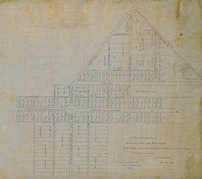
This map, draw in 1808, shows the original lot holders in Emmitsburg.
Note: All maps are the intellectual property of Michael Hillman, President of the Greater Emmitsburg Area Historical Society and therefore covered under U.S. copy write protection law. Your purchase of one of the above three maps is for your personal use only - under no circumstances may the maps be downloaded and resold
in any fashion without the expressed written permission of the Emmitsburg Historical Society.
|