|
List of Maps Created By the Emmitsburg Historical Society
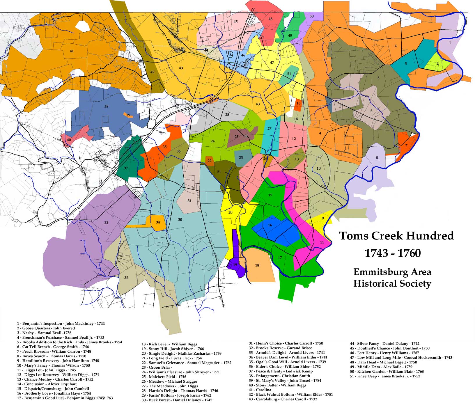
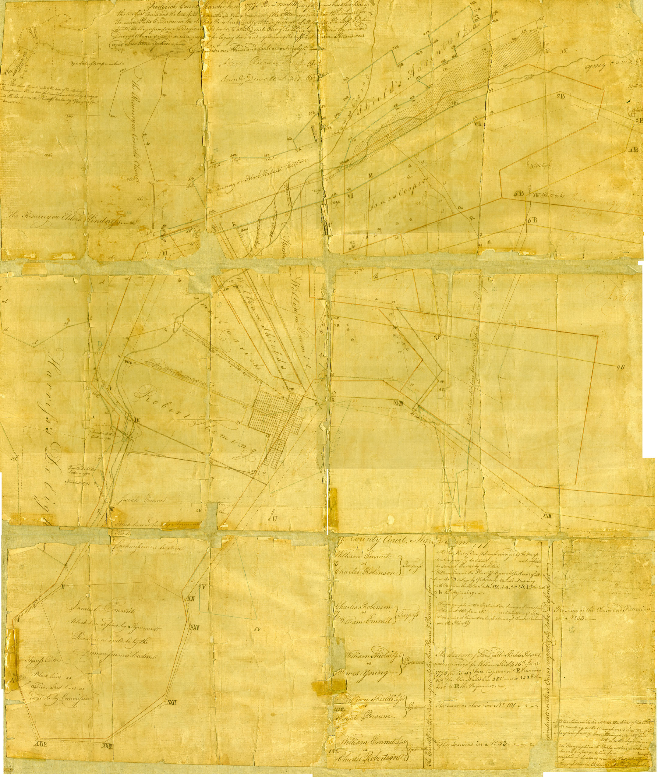
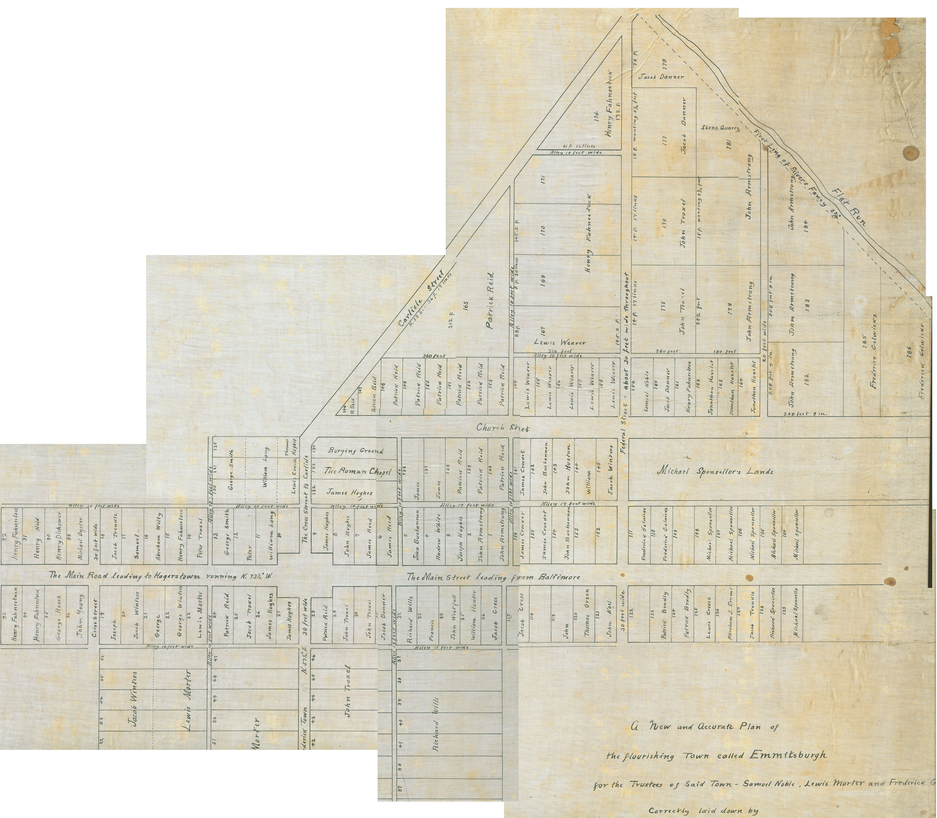
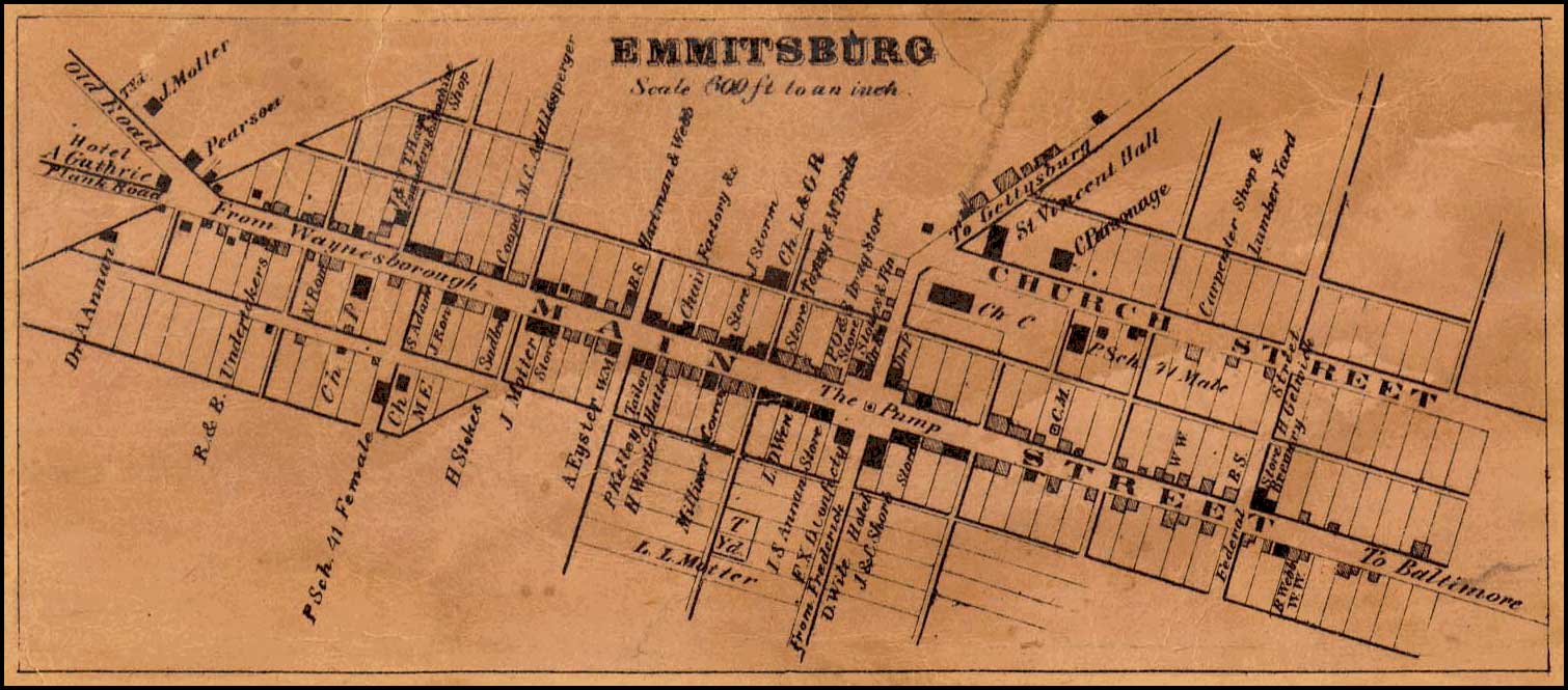
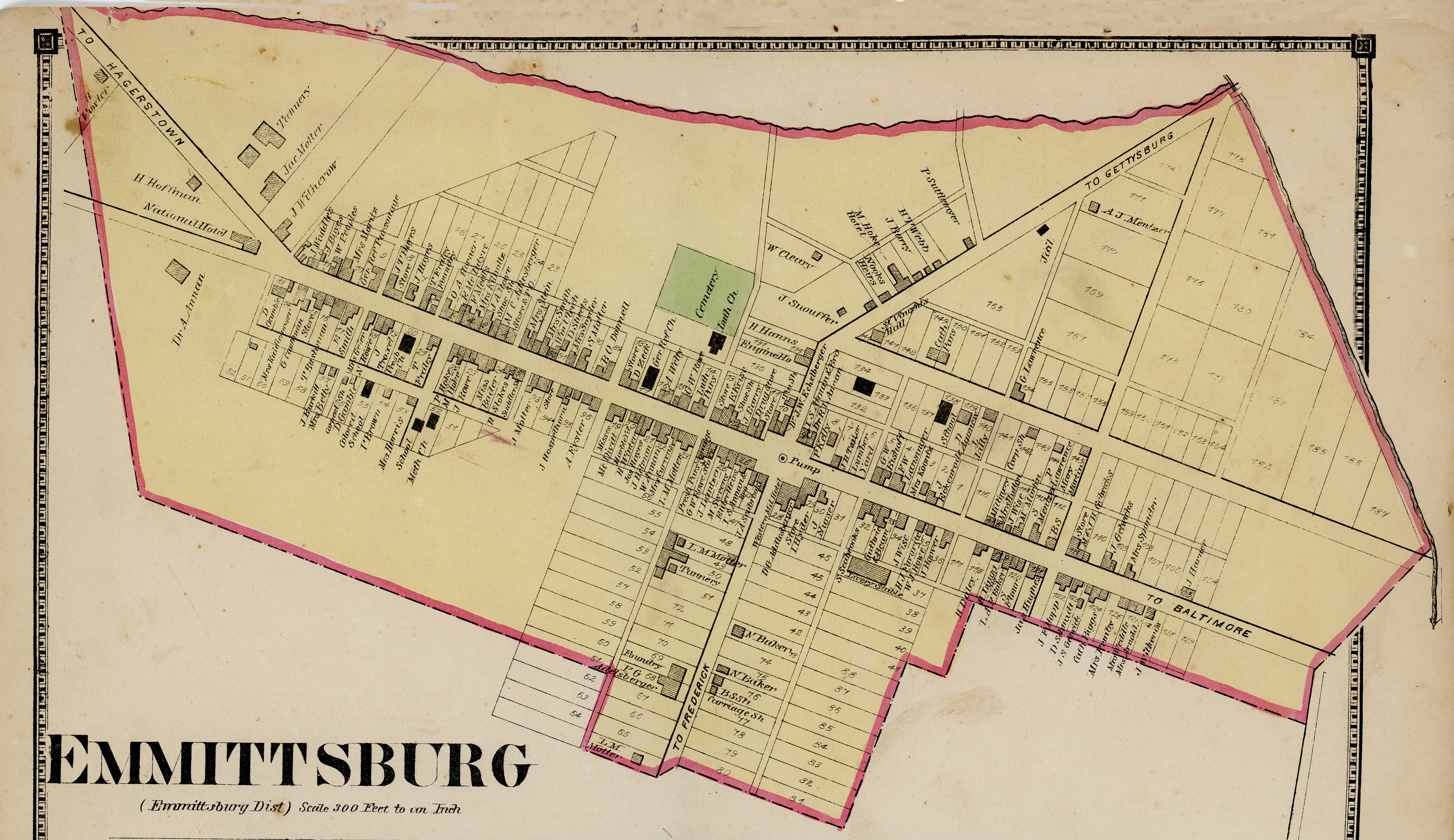
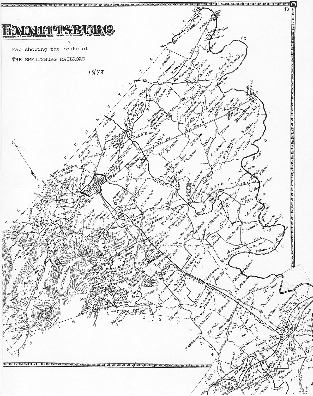
Well we are 2/3rds of the way through our goal of identifying all the landholders since the original royal land grants. Using public records and land transfer deeds, we have produced maps showing the changes of land
ownership for the entire region in ten year increments, beginning in 1754.
It is our fervent hope, that family names identified during this research will trigger input from genealogist and family history buffs from across the country. Our land transfer information is just a skeleton outline of our history, we're depending on visitors like you to add the 'meat to the bones'.
Below is a list of the maps, and links to them, we have created to date. The maps are formatted for views in a computer browser, but are not suitable for printing. If you would like a higher resolution version of any of the map below suitable for printing and framing, please click on the link below.
High resolution maps suitable for printing & framing available for a donation
Note: All maps are the intellectual property of Michael Hillman, President of the Greater Emmitsburg Area Historical Society and therefore covered under U.S. copy write protection law.
The maps are free to download for your own personal use, however under no circumstances may the maps be downloaded and resold in any fashion without the expressed written permission of the Emmitsburg Historical Society.
Maps formatted for viewing on a computer monitor
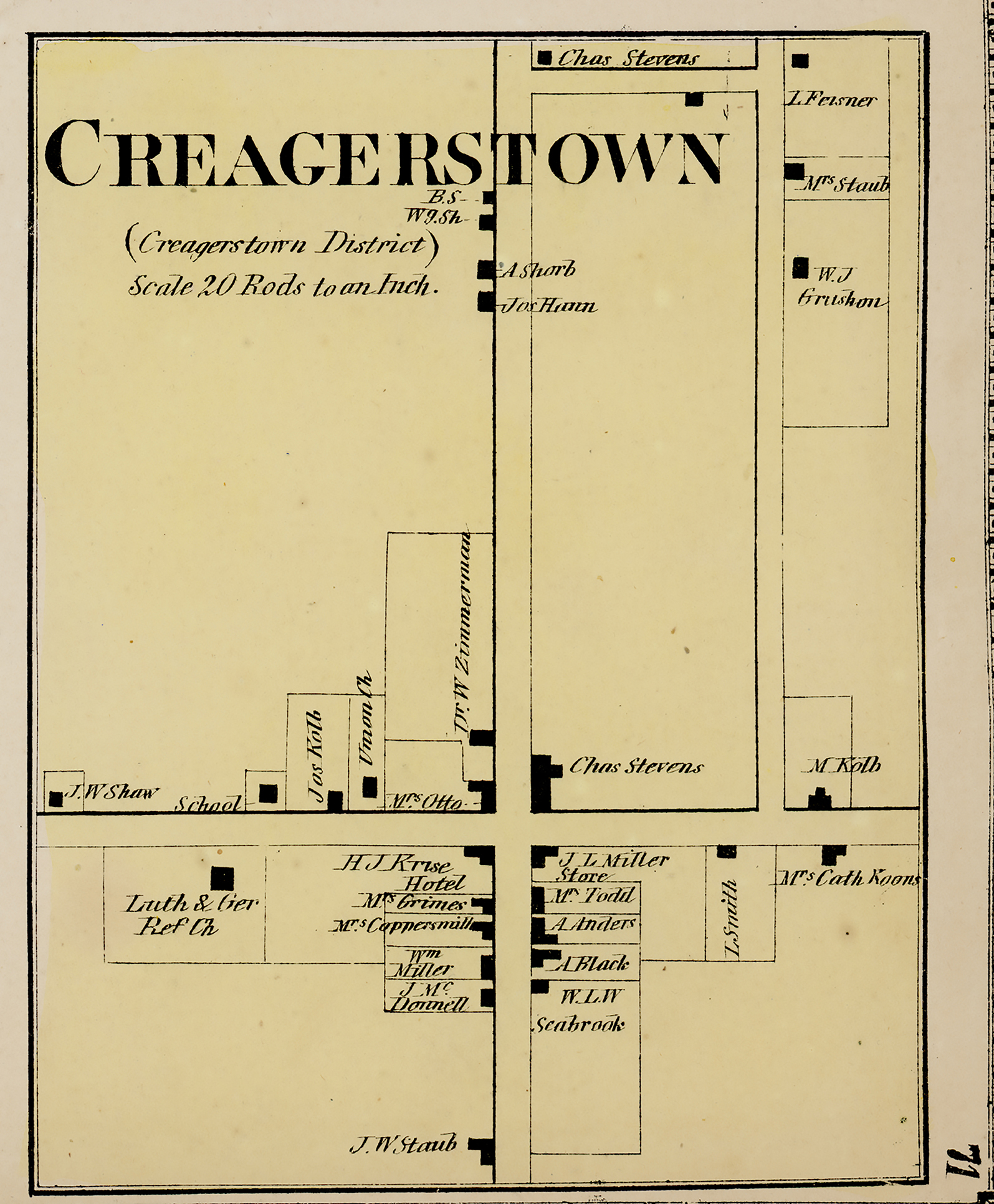
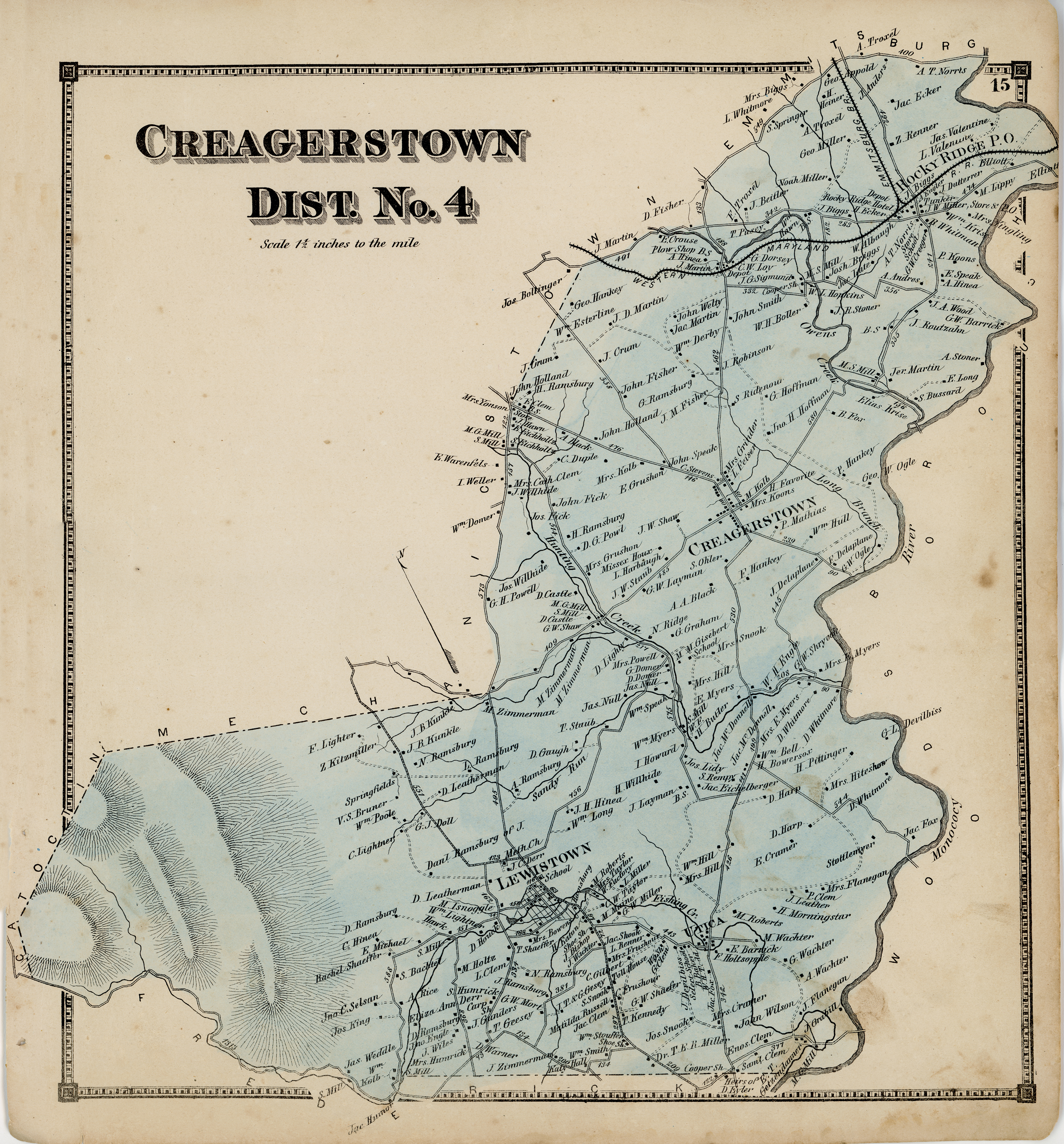
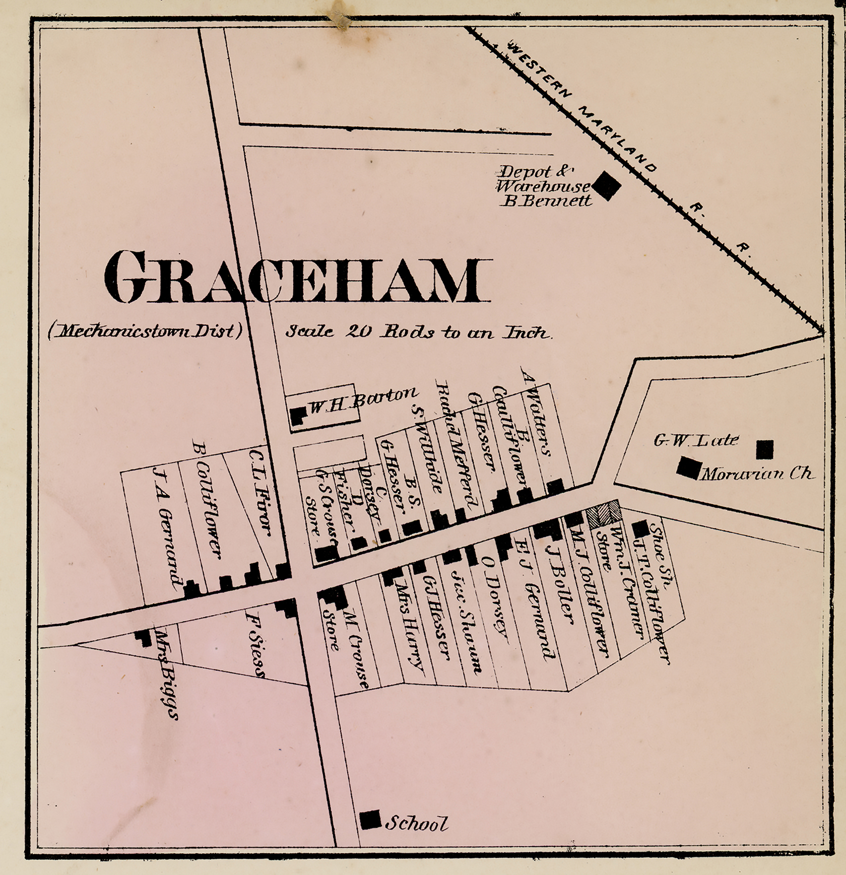
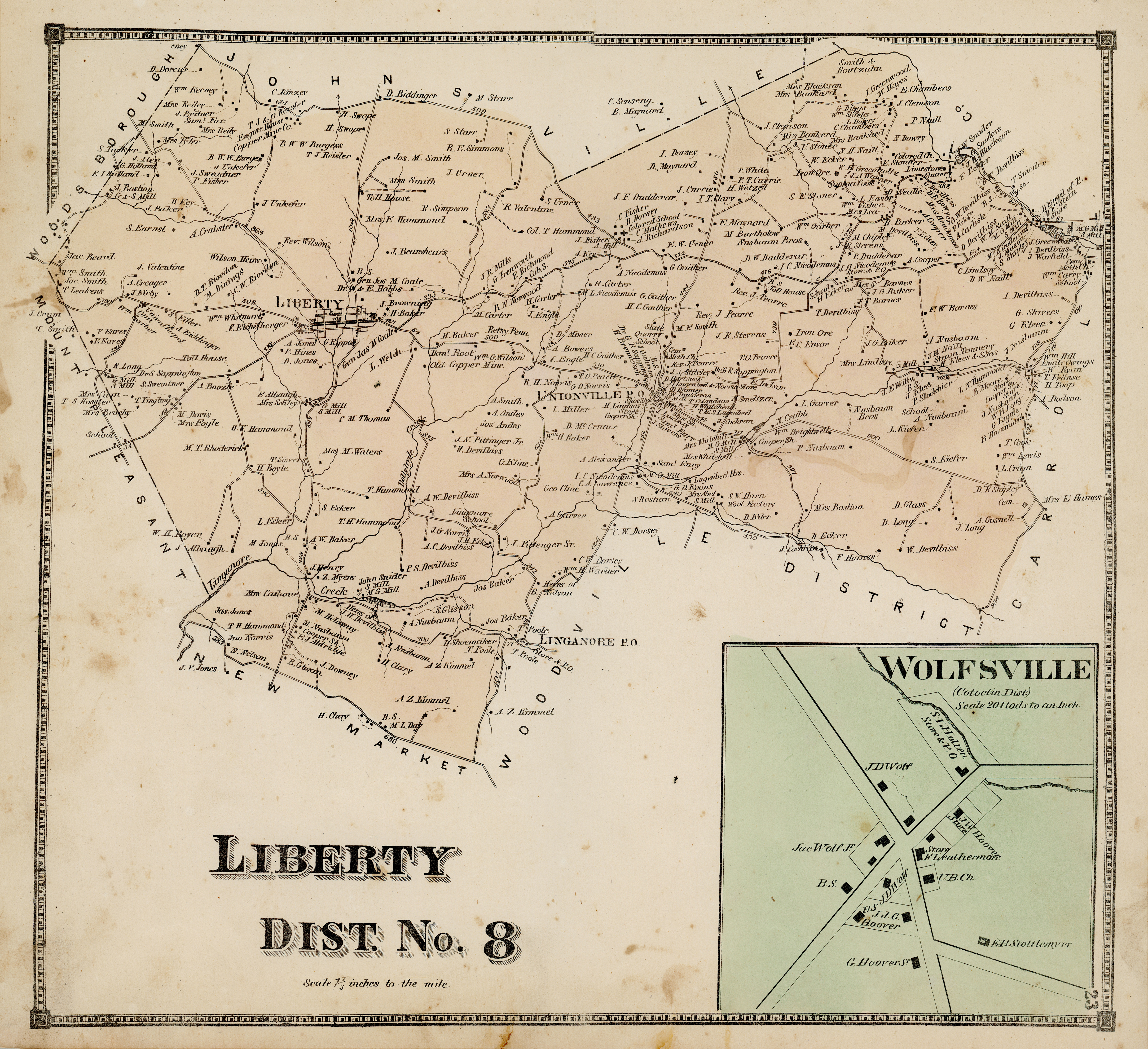
Toms Creek Hundred &c.
Emmitsburg
Land Grants & Farms
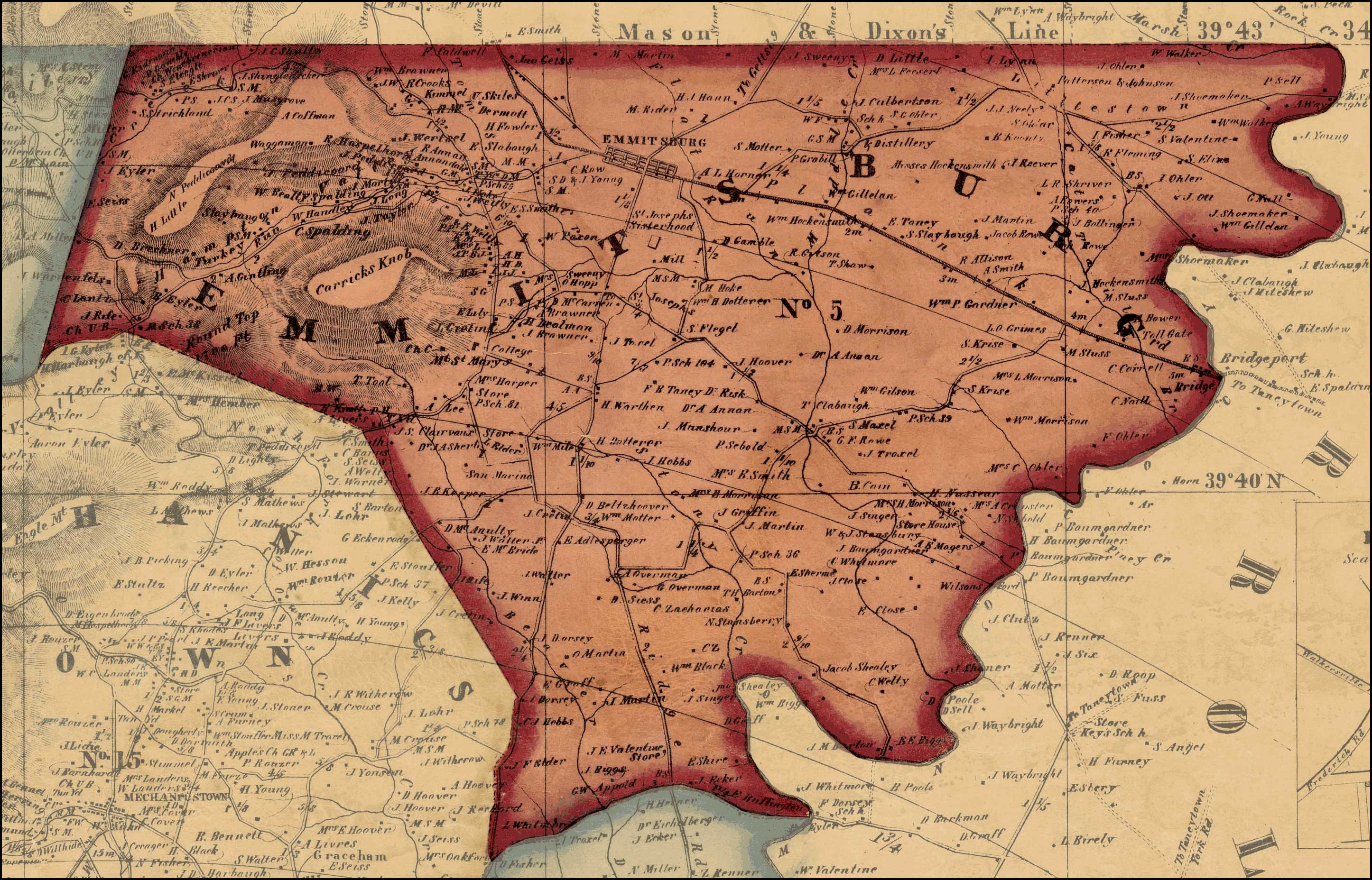
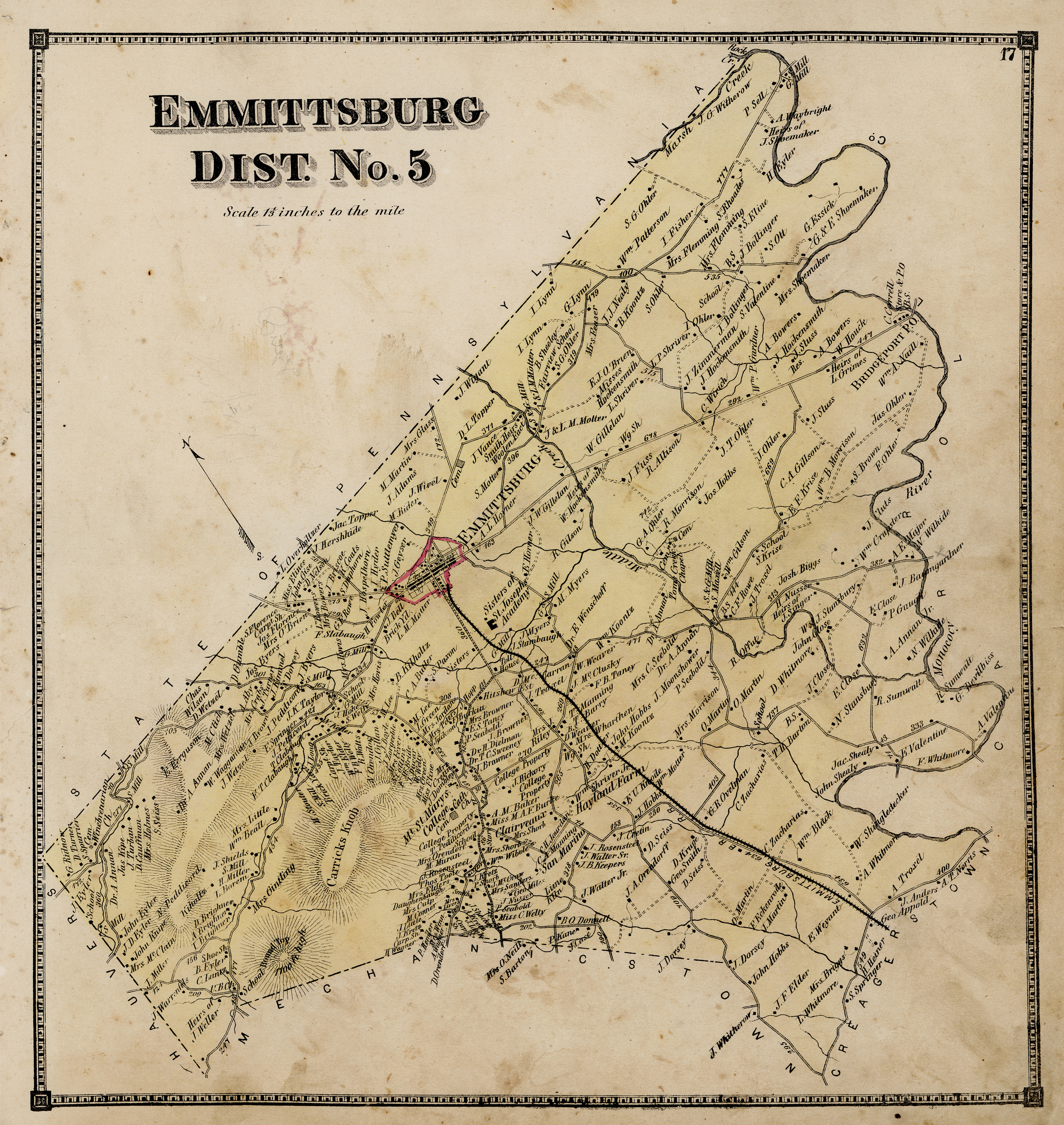
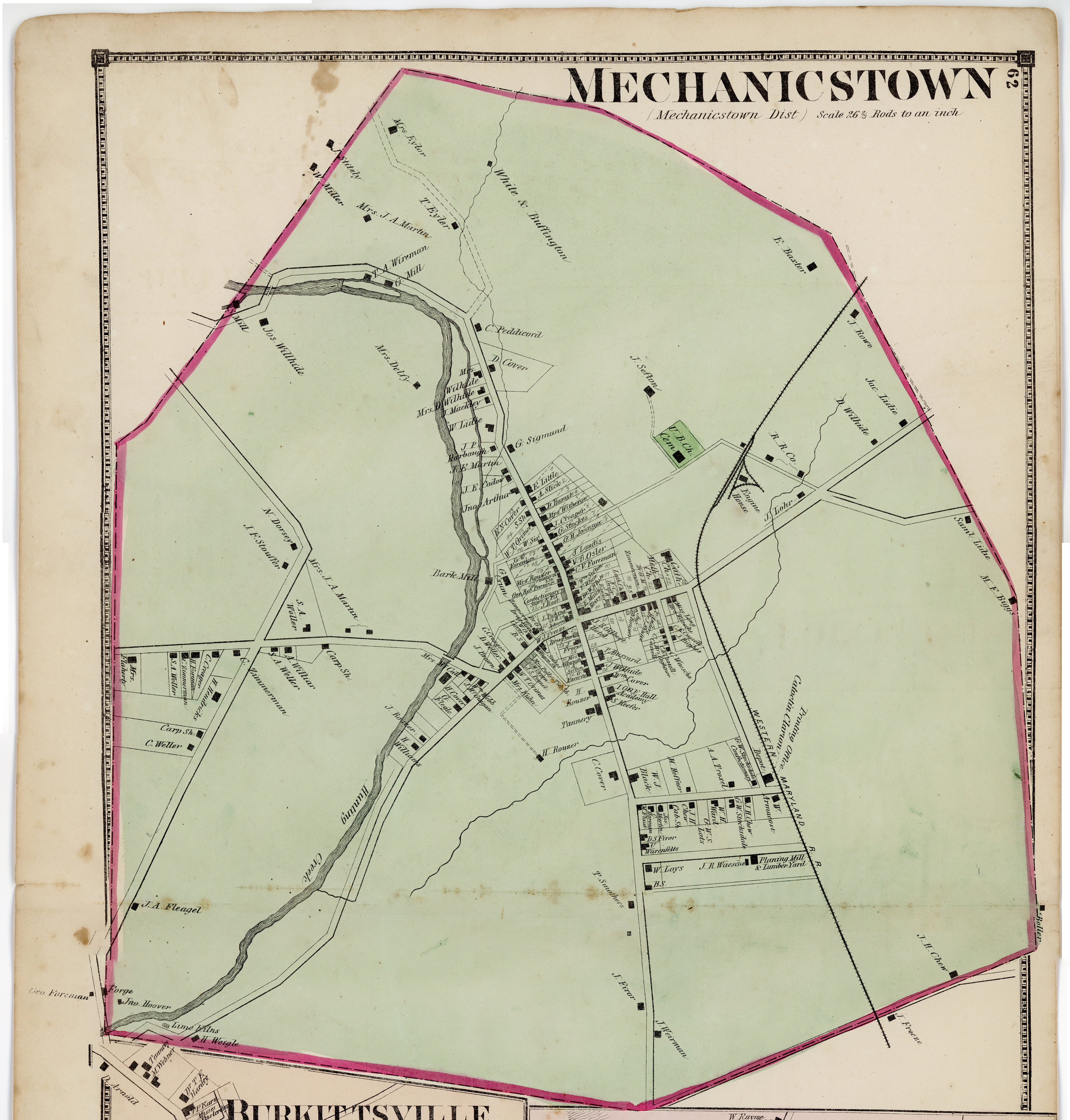
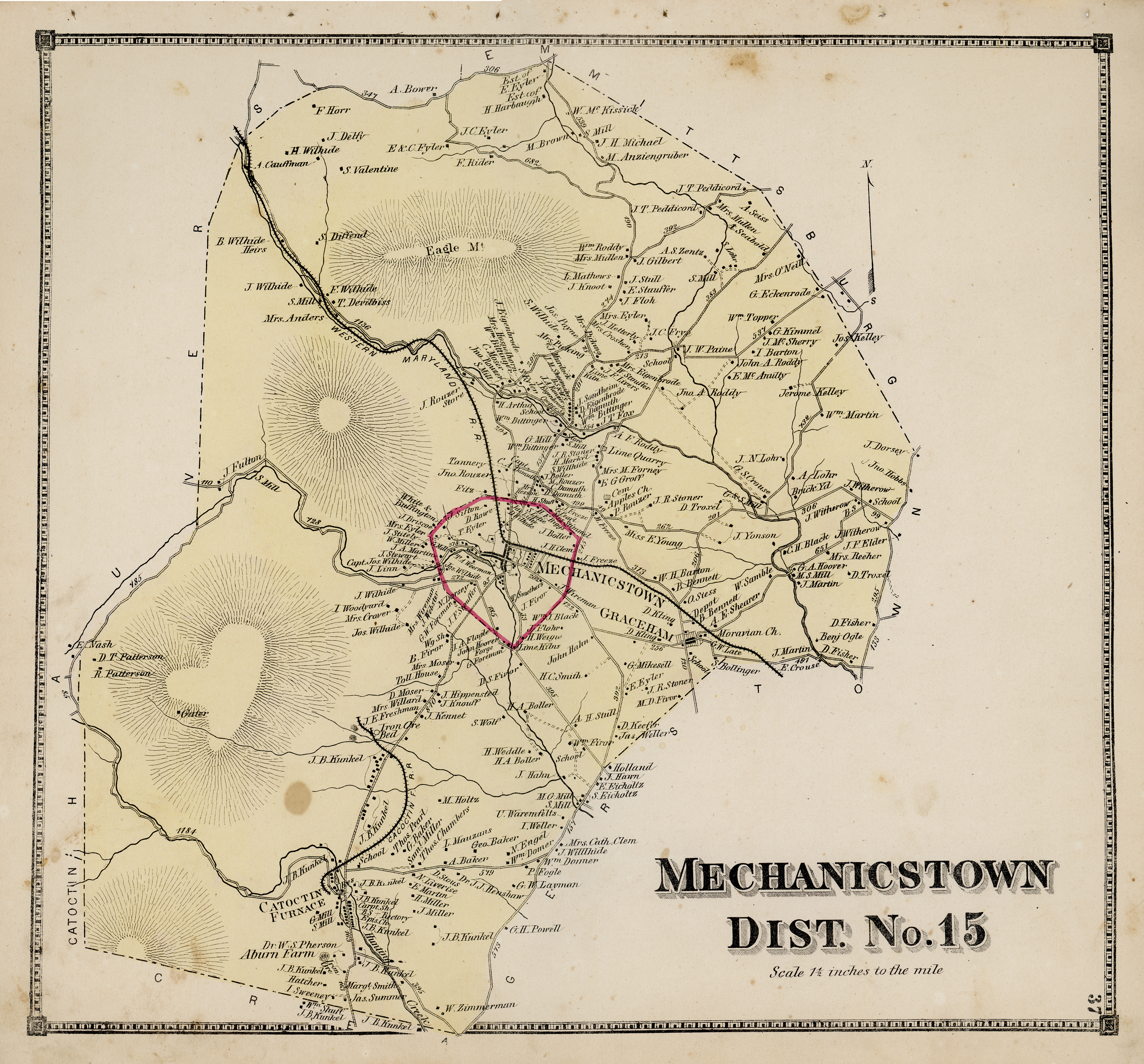
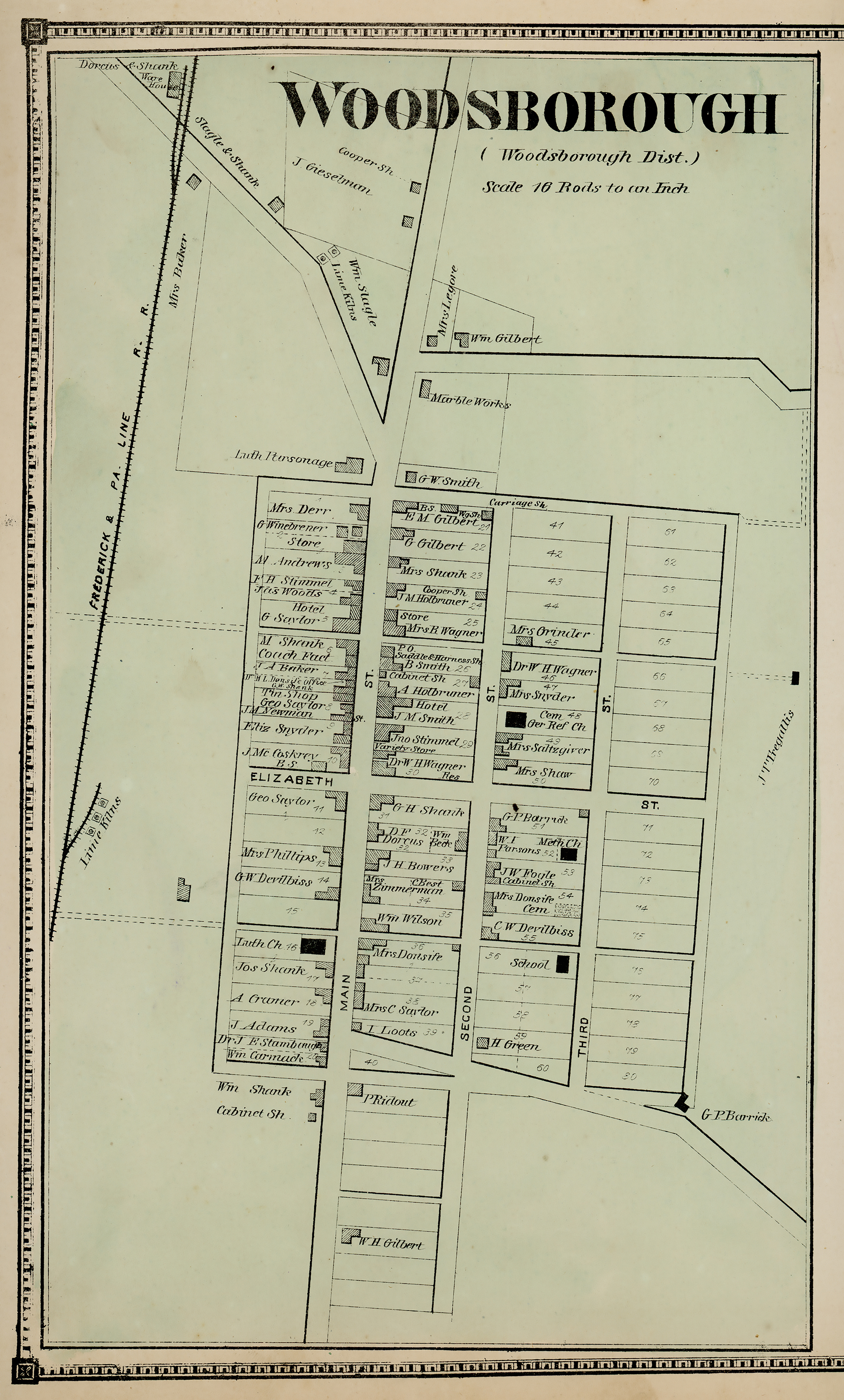
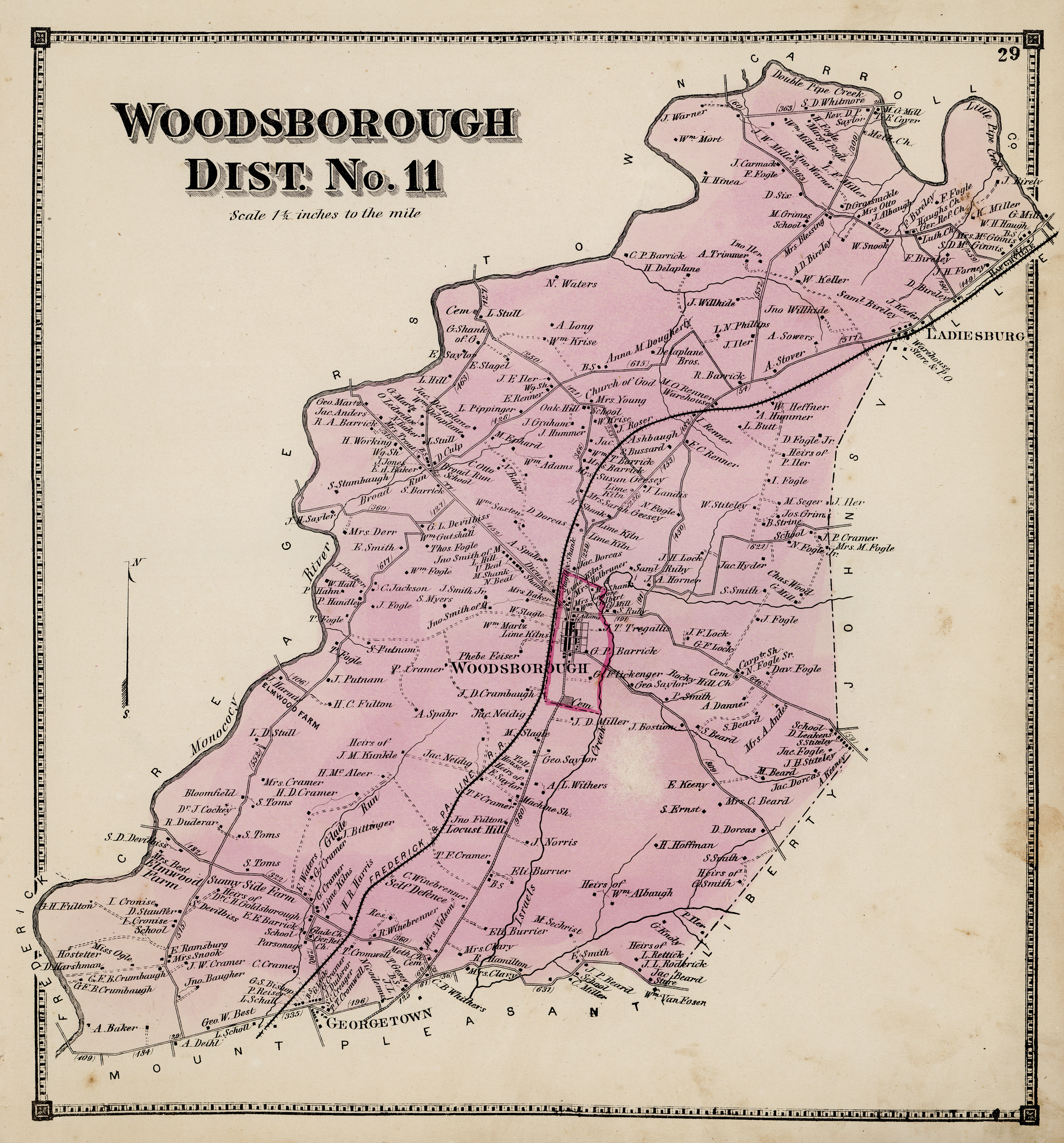
Surrounding Communities - 1873 (all very high resolution)
In addition, we also compiled a list of Historical Land Tract, Homestead, Plantations, & Farms names in the Greater Emmitsburg Area.
If after all this you are unable to find what you are looking for, we suggest you use our site's search engine and type in the name of the family you are looking for.
|